Modern cartography
Since 1958, through the Copyright Library Act, the Biblioteca Nacional has received copies of all maps published. These are maps that are both loose sheets and forming a series, published by government agencies, public and private entities or Autonomous Communities.
The most important series and collections of modern maps are:
1 Topographic maps.
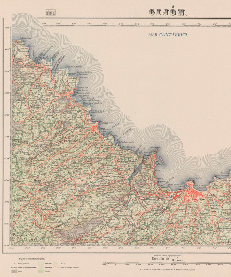
- National Topographic Map. Produced by the National Geographic Institute. The series of National Topographic Maps has been received and preserved since they were first published in 1875, on scales of 1:25,000 (1st, 2nd and 3rd editions and 1st to 4th digital editions) and 1:50,000 (1st to 8th editions, and 1st digital edition).
- Also received and preserved are the series of orthophotomaps produced by the same Institute, on a scale of 1:10,000 and 1:25,000.
- Topographic-military maps. Produced by the Army Geographical Service. The collection includes different basic series, on a scale of 1:250,000 to 1:10,000, divided into subseries: command maps, general maps, special maps, master plans, etc. All these maps range from 1933 to the current year.
- Geologic Maps. Produced by the Geological Institute of Spain. The whole series has been received and preserved since 1866 to the present day, including the National Geological Map of Spain series in all scales, from 1:50,000 to 1:400,000.
- Other thematic maps produced by the same organism have also been received: geomorphological maps, hydrogeological maps, metallogenetic maps, etc.
2 Nautical charts.
Produced by the Hydrographic Institute of the Navy. Charts covering the coasts of Spain, parts of the Atlantic and the Mediterranean Sea are received and preserved. The Coastal Navigation Chart, scale 1:50,000, is the nautical chart of the entire national coastline. Also preserved are general charts for courses, approaches and headings, on scales of between 1:30,000,000 and 1:12,500, and yachting charts covering the entire Spanish coast.
3. Other thematic series
Also received are the series published by the Ministry of Agriculture: Cultivation and Use Map, scale 1:50,000 to 1:200,000; Agrological Classification map, scale 1:50,000; Vegetation Map Series, scale 1:400,000 and Forest Map of Spain, scales 1:400,000 and 1:200,000.
4. Maps published by the Autonomous Communities
Currently, all the Autonomous Communities issue their own cartographic series: basic or topographic cartography and thematic cartography. They also publish series produced with new technologies such as orthophoto, orthoimagery, orthomosaics, etc.
In terms of activity and production, the most important autonomous region cartographic centres are the Cartography Institute of Catalonia, the Institute of Cartography of Andalusia and the Madrid Regional Cartography Department.
5 Maps of Africa.
The collection of africa in the cartographic Service from the legacy Tomás García Figueras is very interesting since it includes some 2,500 maps of the first half of the twentieth century, of the zone of Morocco, Ceuta and Melilla, most of them being erected by the service of the army and the service of the West Africa.
Stresses the series of maps topográfico-militares “ map of the zone of Spanish Protectorate in morocco ”, in its editions of the years 1927-1959.
6 In relief Maps.
The map library 3.7425 3.1779 l-shaped embossed plastics (PVC) have been developed since the late 70 of the twentieth century. The fund focuses so far in the national territory, represented the territory of Spain as a whole or partial representation: autonomous communities, provinces, natural parks, reservoirs, etc.
7 Postcards.
The collection of postcards of Spain is one of the most important at the national level. A source of documentation of great interest for the study of urban transformation and landscape in Spain experienced throughout the twentieth century.
Offer a wide variety of forms of the large existing typology: standard cards, tables, accordion, carpetillas, range, etc.
8 Aerial photography.
One of the most complete collections of aerial photography is the so called Bagüés fund by the military of the air force and the company ’ s founder, Mariano Bagüés Aeropost.
This file is composed of approximately a 67,400 aerial photographs (negative), inventories, graphics and several dozen positive. They are photographs produced by the company Aeropost between 1962 and 1981 where they are photographed the majority of spanish provinces.


