Geography and maps
Since the inception of the Royal Library, the presence of maps and plans was very important given the political and administrative interest that these documents. In both the Royal Library and the National primitive, geography and Travel and astronomy occupied an important place among the various disciplines which shows it is considered first the library catalogue written in 1729 librarian Juan de Iriarte is specifically to funds cartographic: "Regia Matritensis Library Geographica et Chronológica".
Since the creation of the Biblioteca Real, the presence of maps and plans was very important given the political and administrative interest of these documents. Both in the Royal Library and in the original Biblioteca Nacional, geography and travel and astronomy were prominent subjects. Evidence of this is what is considered to be the first library catalogue written in 1729 by the librarian Juan de Iriarte, specifically dedicated to the cartographic assets: "Regia Matritensis Biblioteca Geographica et Chronológica".
The first mention made of collections of "geographical and hydrographical maps" comes from the work of Basilio Castellanos published in 1847 " Apuntes para un catálogo de objetos que comprende la colección del Museo de Antigüedades de la Biblioteca Nacional...: acompañado de un ligera reseña... de los demás departamentos de la misma Biblioteca...". Most of the sections of the Library were created in the second half of the nineteenth century. In 1876, according to Breton and Orozco, the Maps and Plans Section had already appeared within the Printed Documents Department.
The original assets of the cartographic collection comprise holdings from the Royal Library, assets brought by Felipe V from France, and those that were added to the Library from different sources, forming collections or atlases. The collection increased considerably in 1913 with the transfer of assets from the Geographical Office of the First Secretariat of State or Ministry of State. Around the same time the López Garat bequest of manuscript maps must have been incorporated.
All these collections and the major acquisitions of later periods have placed the Maps section of the Biblioteca Nacional on a par with the most important national cartography libraries in Spain.
Today, the Cartography Service preserves an important collection of ancient and modern cartographic assets from around the world, although most come from Spain; atlases and specialist works in cartography, geography, astronomy, descriptions of countries and journeys, and a collection of postcards of cities and geographical locations .
THE HOLDINGS
The Cartography Service at the Biblioteca Nacional originated from the assets acquired from the Royal Library and the cartographic collections of the Geographic Office of the First Secretary of State. Its core consisted of the collection called the Mendoza Collection, the maps produced by the López family, and the collection of manuscript maps which form the basis of the original cartographic heritage.
In modern cartography, since 1958, through the Copyright Library Act, the Biblioteca Nacional has received copies of all maps published both as loose sheets or forming a series, issued by government agencies, public and private entities and Autonomous Communities.
2.1 Cartography
2.1.1 Ancient Maps
The Cartography Service at the Biblioteca Nacional originated from the assets acquired from the Royal Library and the cartographic collections of the Geographic Office of the First Secretary of State, and from the Universal Office, which Godoy commissioned the cartographers Tomás López and Juan López, his son, to organise in 1795.
This collection was incorporated into the Library in 1913 by Royal Decree on 7 June. Its core consisted of the collection called the Mendoza Collection, the maps produced by the López Family and the collection of manuscript maps.
2.1.1.1 Mendoza Collection
Formed by Captain Jose Mendoza Rios, commissioned by the Secretary of State to travel to England to acquire the best maps and geographical works published. Mendoza, excellent mathematician and astronomer, gathered two magnificent collections, one of travel books and another of maps, printed mostly in England, although some were published in France, Germany, Spain, Russia, etc. It comprises about 2,400 maps of great value, since they were produced during the period of greatest growth of scientific geography in Europe.
2.1.1.2 Manuscripts Maps
The collection of manuscript maps of the Biblioteca Nacional is of great interest. Many of them, the most important, are in the Manuscripts Service, included in different works; also preserved are Portolan charts, maps and charts on separate sheets. The largest collection is in the Cartography Service and consists of maps originating from the First Secretary of State. Also part of this magnificent collection are the maps originating from the Royal Library and the Garat López bequest.
They consist mostly of eighteenth century maps drawn by military engineers. The subject matter is very varied, since the Ministry of State deals with matters as wide ranging as foreign relations, health, public works, postal services, roads and canals, shipping companies, etc.
2.1.1.3 Maps from the Lopez family
This is an almost compete collection of the maps drawn, engraved and published by Tomás López his sons Juan and Tomás Mauricio. They are maps and plans, in loose sheets or forming atlases, mostly of Spain and its provinces, military possessions, and the American colonies. It also includes maps of all the continents and major European countries.
The collection is interesting because López was the first Spanish cartographer to systematically record and publish maps depicting eighteenth-century Spain. It is also very useful for the history of cartography, as the sources used are almost always cited.
2.1.2 Modern maps
Since 1958, through the Copyright Library Act, the Biblioteca Nacional has received copies of all maps published. These are maps that are both loose sheets and forming a series, published by government agencies, public and private entities or Autonomous Communities.
The most important series and collections of modern maps are:
2.1.2.1 Topographic maps
- National Topographic Map. Produced by the National Geographic Institute. The series of National Topographic Maps has been received and preserved since they were first published in 1875, on scales of 1:25,000 (1st, 2nd and 3rd editions and 1st to 4th digital editions) and 1:50,000 (1st to 8th editions, and 1st digital edition).
- Also received and preserved are the series of orthophotomaps produced by the same Institute, on a scale of 1:10,000 and 1:25,000.
- Topographic-military maps. Produced by the Army Geographical Service. The collection includes different basic series, on a scale of 1:250,000 to 1:10,000, divided into subseries: command maps, general maps, special maps, master plans, etc. All these maps range from 1933 to the current year.
- Geologic Maps. Produced by the Geological Institute of Spain. The whole series has been received and preserved since 1866 to the present day, including the National Geological Map of Spain series in all scales, from 1:50,000 to 1:400,000.
- Other thematic maps produced by the same organism have also been received: geomorphological maps, hydrogeological maps, metallogenetic maps, etc.
2.1.2.2 Nautical charts
Produced by the Hydrographic Institute of the Navy. Charts covering the coasts of Spain, parts of the Atlantic and the Mediterranean Sea are received and preserved. The Coastal Navigation Chart, scale 1:50,000, is the nautical chart of the entire national coastline. Also preserved are general charts for courses, approaches and headings, on scales of between 1:30,000,000 and 1:12,500, and yachting charts covering the entire Spanish coast.
2.1.2.3 Other thematic series
Also received are the series published by the Ministry of Agriculture: Cultivation and Use Map, scale 1:50,000 to 1:200,000; Agrological Classification map, scale 1:50,000; Vegetation Map Series, scale 1:400,000 and Forest Map of Spain, scales 1:400,000 and 1:200,000.
2.1.2.4 Maps published by the Autonomous Communities
Currently, all the Autonomous Communities issue their own cartographic series: basic or topographic cartography and thematic cartography. They also publish series produced with new technologies such as orthophoto, orthoimagery, orthomosaics, etc.
In terms of activity and production, the most important autonomous region cartographic centres are the Cartography Institute of Catalonia, the Institute of Cartography of Andalusia and the Madrid Regional Cartography Department.
2.1.2.5 Maps of Africa
Within the Modern Maps holdings it is interesting to note the collection of maps of Africa bequeathed by General Tomás García Figueras, Delegate for Indigenous Affairs in Morocco. This collection includes some 2,500 maps from the first half of the twentieth century, mostly from Morocco, Ceuta and Melilla, most of them produced by the Army Geographical Service and the Geological Survey of Spanish West Africa, and published by the office of the Governor General of the Spanish Sahara, the Delegate for Indigenous Affairs and the Technical Secretariat of Morocco. The series of topographic-military maps and 1st, 2nd and 3rd editions from 1927 to 1959 of the «Mapa de la zona del Protectorado Español en Marruecos» [Map of the area of the Spanish Protectorate in Morocco] are important.
2.1.2.6 Digital cartography
The Biblioteca Nacional preserves a small but growing collection of maps on CD-ROM that is currently being described in order to be made available in the Reading Room.
2.2 Books and atlases
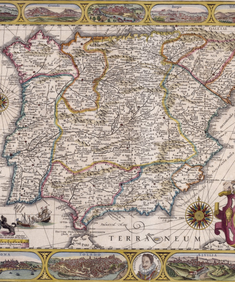
The Cartography Service preserves over a thousand works on cartography, geography, astronomy, travel, etcetc., including an important collection of Flemish, Dutch, French, Italian, English, German and Spanish atlases from the sixteenth to eighteenth centuries. Also worth mentioning is the Condeminas collection of books on navigation, donated in 1969.
The Library also preserves a large collection of Spanish and foreign modern atlases, to which new acquisitions are constantly added, and a specialised collection of reference works.
2.2.1 The Royal Geographical Society Library
Since 1971, the Cartography Service has held the interesting collection of maps, books, magazines and pamphlets from the Spanish Royal Geographical Society, founded in 1876. This consists of about 5,000 volumes and nearly as many pamphlets, more than 8,000 maps and a magazine collection of approximately 1,100 titles. Of great interest are the assets from the nineteenth century, particularly those related to North Africa. This collection specialises in general and historical geography, geology, cartography, topography and books on travel and discoveries.
2.3 Tourism and postcards
The tourist pamphlet has been an important vehicle for advertising and promoting Spain, focussing on general, cultural, and historical themes, monumental-historical heritage, popular traditions, etc., and including photographs of tourist attractions in Spain. The Biblioteca Nacional has been gathering this source of information and printed propaganda, and has formed an important collection of pamphlets from the first half of the twentieth century, including those dating from the Second Republic and the Civil War period, and other more modern brochures, including those printed today.
The modern assets also include an important collection of over 600,000 postcards depicting cityscapes, landscapes, etc.., primarily Spanish. They are arranged geographically and are of great interest for the study of the transformation of urban settings and countryside in Spain in recent years.

![[Derrotero del Mediterráneo y costa atlántica]](/sites/default/files/styles/bloque_imagen_cabecera_xl/public/repositorio-imagenes/derrotero-mediterraneo-vitr421_0.jpg?h=27ca3d0e&itok=uzt4RYj0)
![[Derrotero del Mediterráneo y costa atlántica]](/sites/default/files/styles/bloque_obras_imagenes_xl/public/repositorio-imagenes/derrotero-mediterraneo-vitr421_0.jpg?h=dd4607c5&itok=w56PnYVY)



![[Atlas de Battista Agnese]](/sites/default/files/styles/bloque_obras_imagenes_xl/public/repositorio-imagenes/atlas-battista-agnese-res-176-_0.jpg?h=b2d9623f&itok=xYxB5YFa)
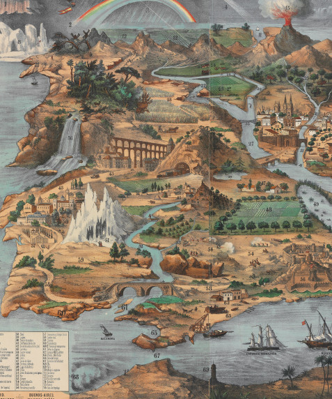
![[Derrotero del Mediterráneo y costa atlántica]](/sites/default/files/styles/bloque_colecciones_home_xxl/public/repositorio-imagenes/derrotero-mediterraneo-vitr421_0.jpg?h=905d8f48&itok=p9VvvQ9E)
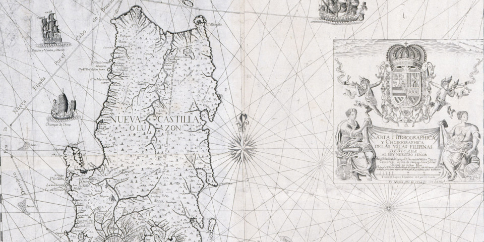
![[Atlas de Battista Agnese]](/sites/default/files/styles/bloque_colecciones_home_xxl/public/repositorio-imagenes/atlas-battista-agnese-res-176-_0.jpg?h=0d6bb6a9&itok=rv7IM_g-)
